
The System of Record for Recreation Asset Status
Driftwise helps water trail organizations, parks departments, and outdoor recreation managers publish authoritative, real-time status updates to the public.
Everything You Need to Manage Recreation Status
Purpose-built for water trails, river corridors, and parks. One product, one job, done better than anyone else.
Corridor & Asset Management
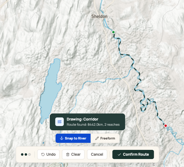
Define your water trail, river corridor, or park assets with a structured schema. Track access points, hazards, segments, and more with full attribution and versioning.
Status Workflow Engine
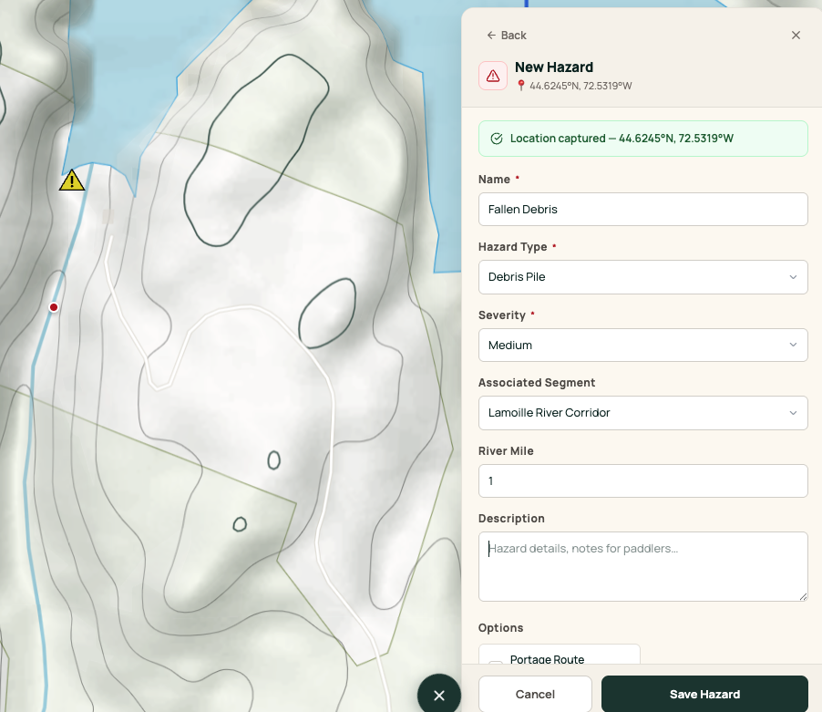
Publish closures, advisories, hazards, and condition updates with confidence. Built-in verification states, urgency levels, and conflict detection keep your information trustworthy.
Public Publishing Layer
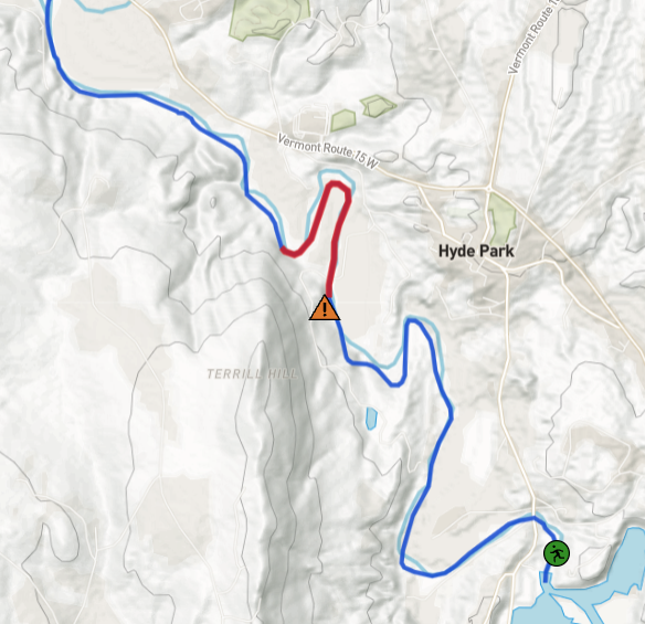
Branded public pages with color-coded maps. Embeddable widgets for your website. Mobile-optimized, shareable URLs that keep paddlers informed.
Trust & Accountability
Full provenance on every update. Know who published what, when, and why. Role-based access control and audit logs for complete transparency.
Organization Admin
Invite team members with Admin, Editor, or Viewer roles. Configure approval workflows for government compliance. Manage your organization settings in one place.
Data Import & Export
Bring your existing data via CSV, GeoJSON, or KML. Export anytime. Webhooks for real-time integration with your systems.
From Setup to Published in Minutes
Driftwise is designed for trail managers, not GIS experts. Simple workflows that respect your time.
Set Up Your Corridor
Define your water trail or park assets using our guided setup wizard. Import existing data or draw directly on the map. Add access points, segments, and hazard locations.
Publish Status Updates
When conditions change, publish in under 3 minutes. Choose status type (closure, advisory, hazard), set verification level and urgency, add details, and hit publish.
Inform the Public
Your public map page updates instantly. Visitors see color-coded status indicators, detailed descriptions, and shareable links. Embed the map widget on your own website.
Real-Time Hydrological Awareness
Combine in-situ USGS gauge data with NOAA's National Water Model to get a complete picture of conditions along your corridors — from current flows to 5-day forecasts.
USGS Stream Gauges
Real-time observations
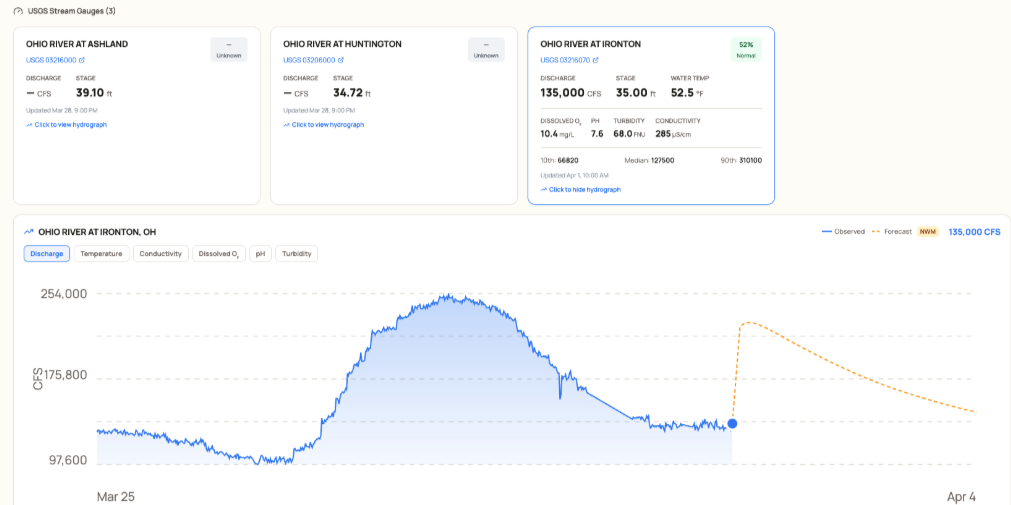
- Discharge, stage, and water temperature
- Water quality: pH, dissolved oxygen, turbidity, conductivity
- RFC-calibrated forecasts where available
National Water Model
Continuous coverage + forecasts
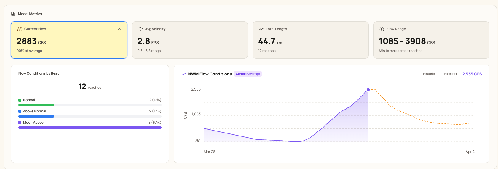
- Flow and velocity for every reach — no gauge required
- Percentile-based flow status (normal, above, below)
- 5-day forecast trends with model confidence
Make data-driven decisions about conditions, closures, and advisories.
See Intelligence in action
Ready to Transform How You
Manage Recreation Assets?
Join leading water trail organizations and parks departments who trust Driftwise to publish authoritative status updates. Book a personalized demo today.
Request a DemoFree demo · No commitment · See results in 30 minutes
Ready to Modernize Your Status Management?
Join water trail organizations and parks departments who trust Driftwise to keep their communities informed.
-
Free consultation call
We'll discuss your needs and show you a demo
-
Guided onboarding
We help import your data and configure your setup
-
No long-term commitment
Start with a pilot program, expand when ready
Reach out to our team
Tell us about your corridor or park and we'll set up a free consultation call. We respond within 1 business day.
Click to reveal — we obscure addresses to reduce spam.